Download the PicoR-Ice device presentation
PicoR GPR is a geophysical device designed for subsurface sensing and monitoring of opaque environments: ice, snow, road pavement, soil, etc. Based on retrieved data the device allows to calculate the thickness of the layers inside environments or to detect and calculate the distance to the inhomogeneities inside environments.
Later it is described the use of PicoR GPR as the ice and snow thickness measuring device PicoR-Ice which is its main area of application.
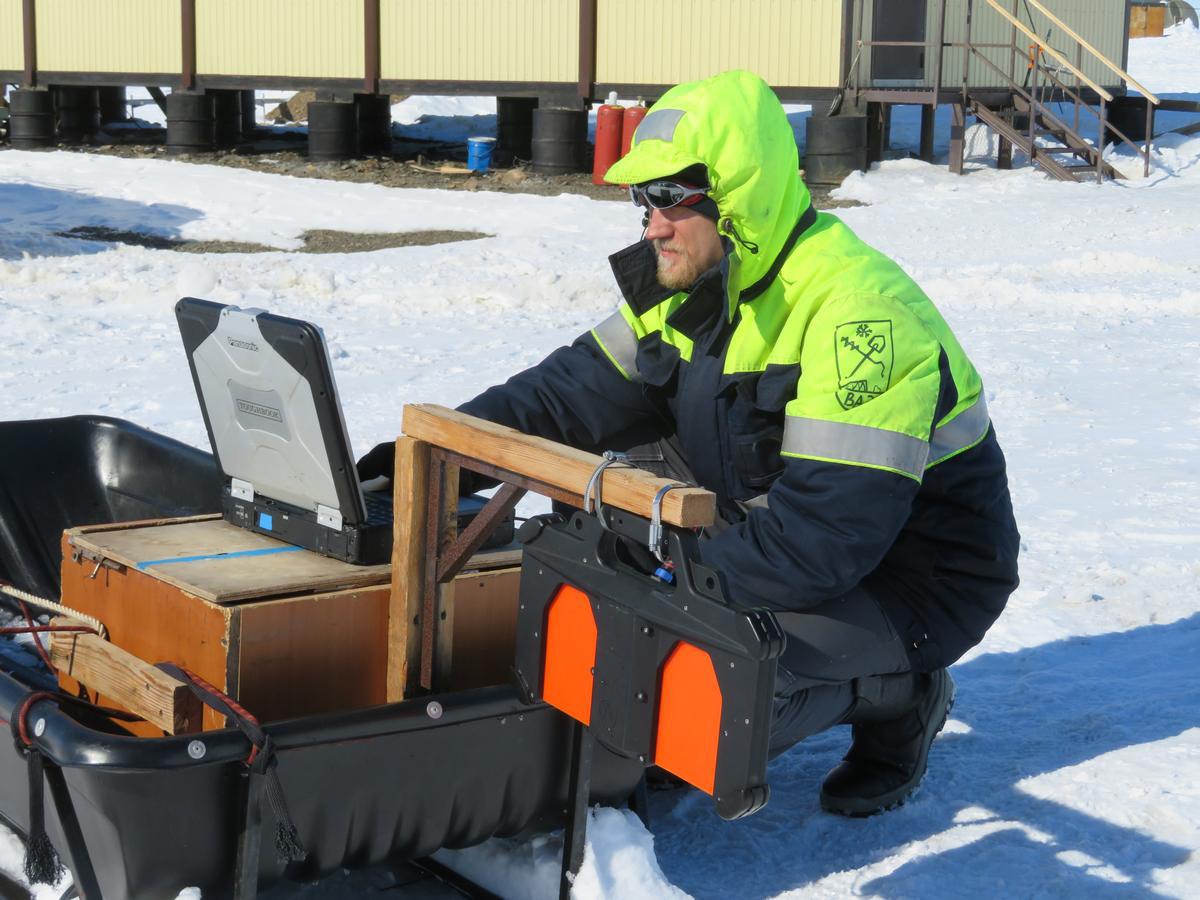
Device is intended for contactless operative determination of ice thickness and structure in the point and during the movement in real time as well as for recording and subsequent viewing of ice profile (with reference to the coordinate using the GPS/GLONASS receiver) on winter roads and ice crossings. The device can be used both in the handheld version and in the transport version.
The benefits of PicoR-Ice compared to the traditional drilling method of ice thickness measurement using ice screws and measuring ruler:
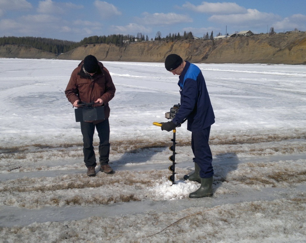
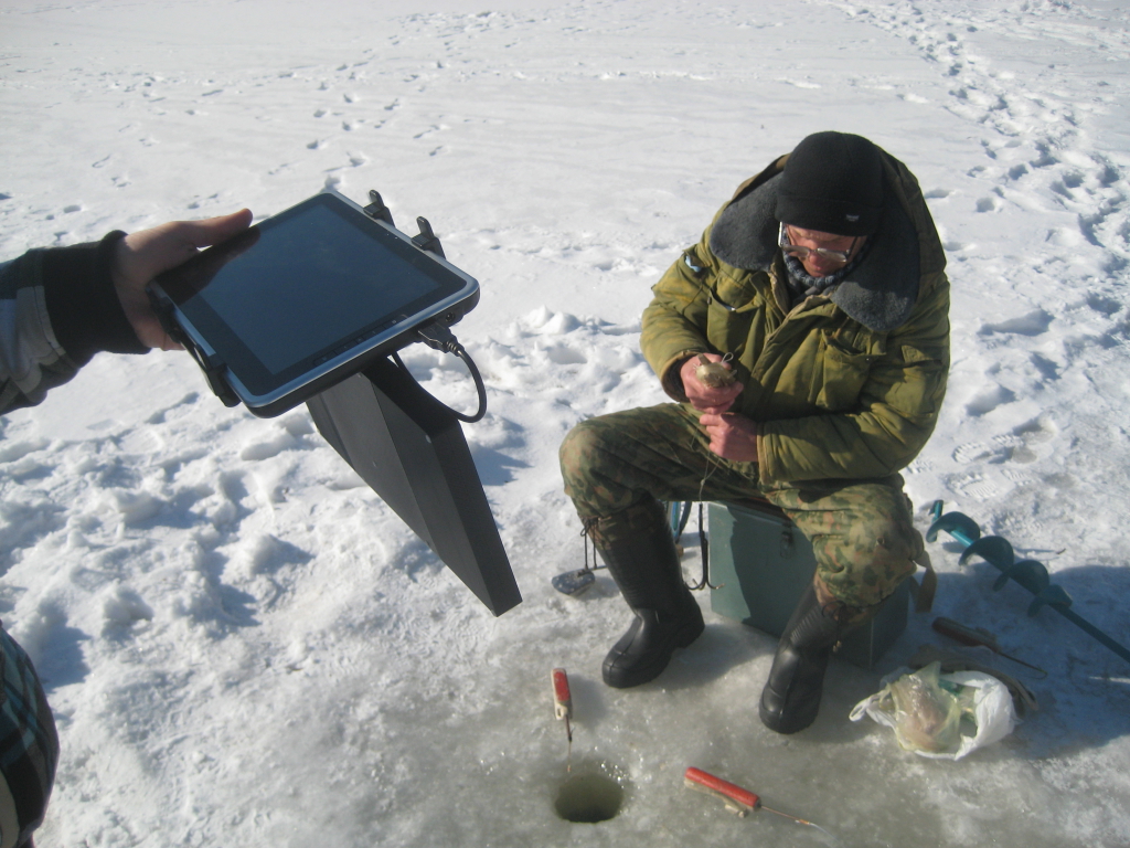
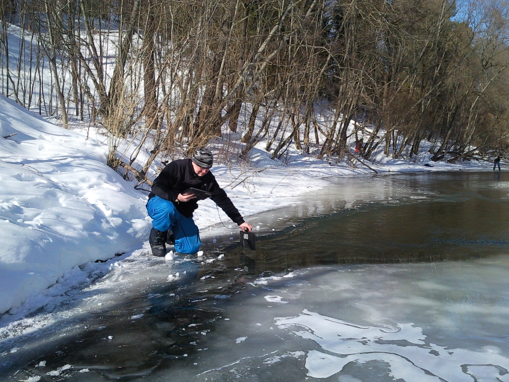
- significantly less labor intensity and time consuming. The measurements can be made much easier. No more need to drill holes, it’s enough to hold the antenna module a few seconds above the ice surface at a height of 0.5 m and you can see the ice thickness on the screen of the tablet PC
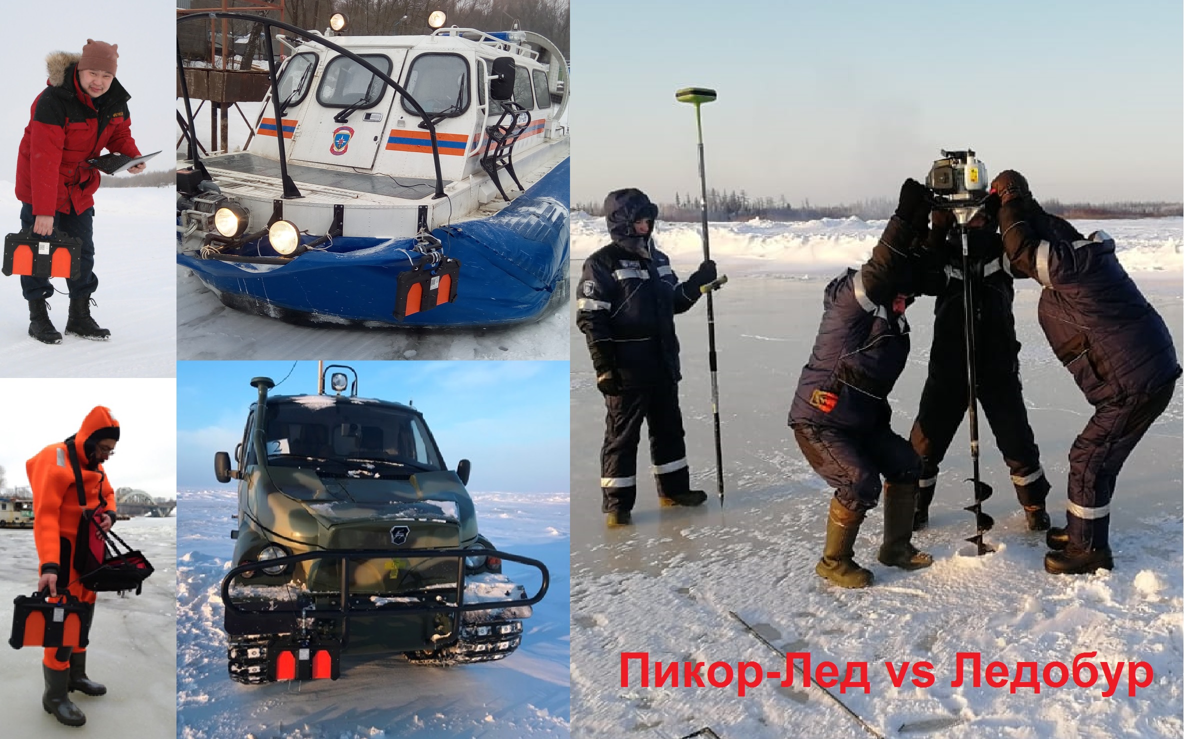
- measurements are performed on the entire ice surface, not on just a few points. Between these points it can be polynya (ice-hole) which is PicoR-Ice can “see” and ice screws – can not
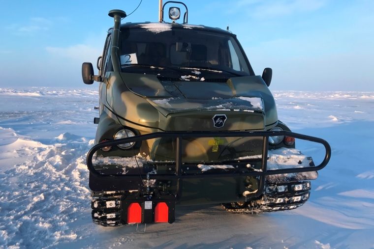
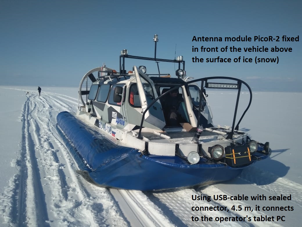
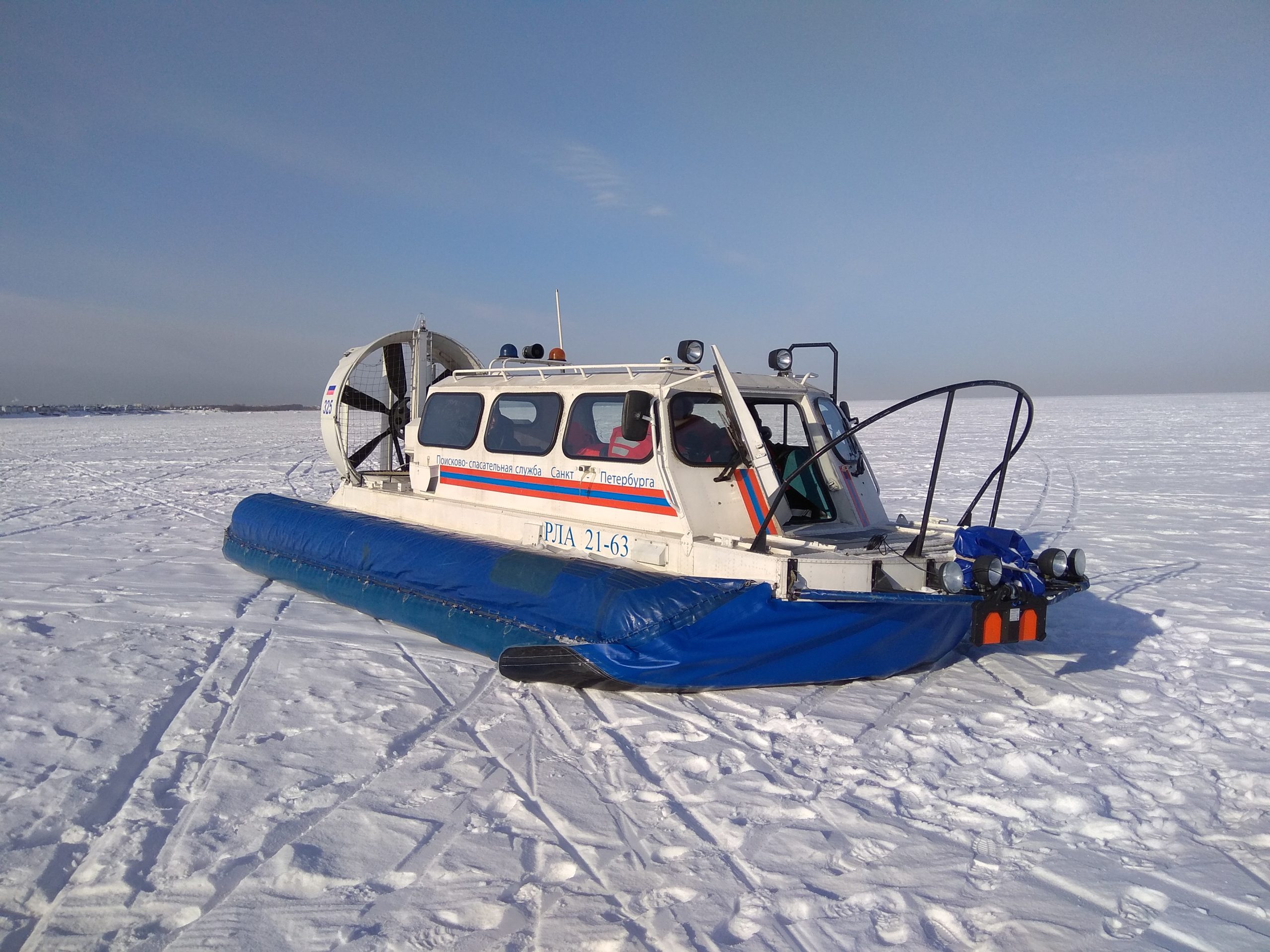
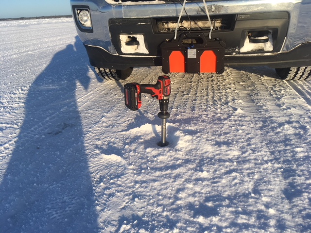
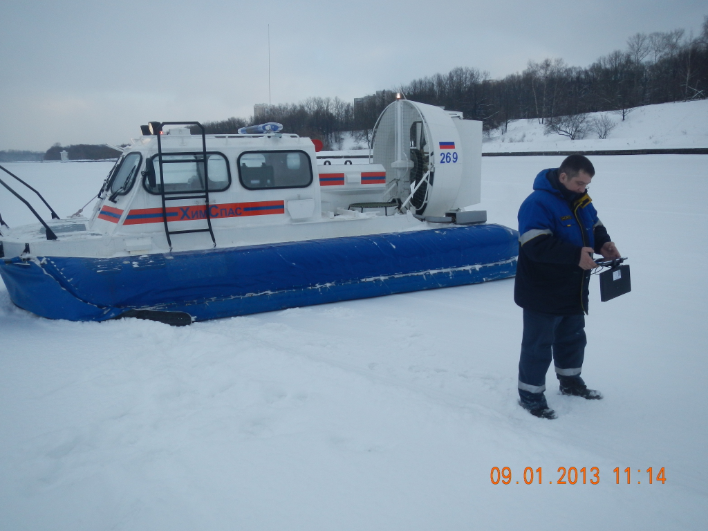
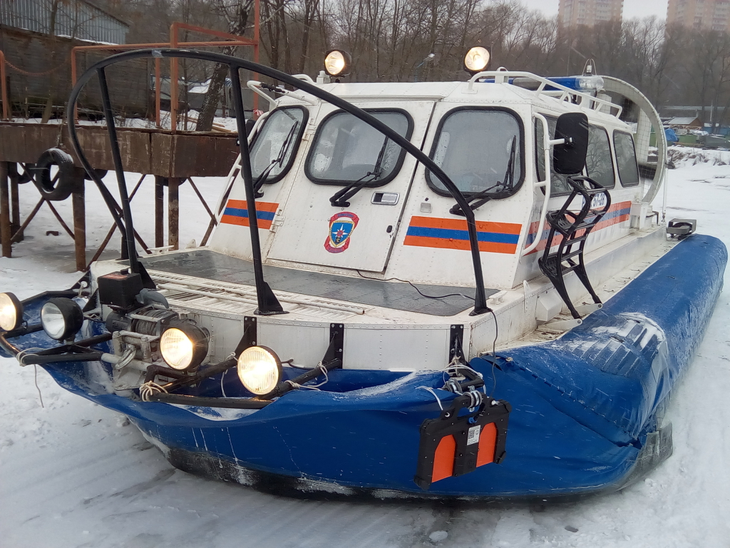
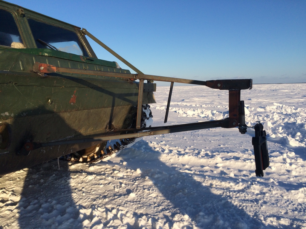
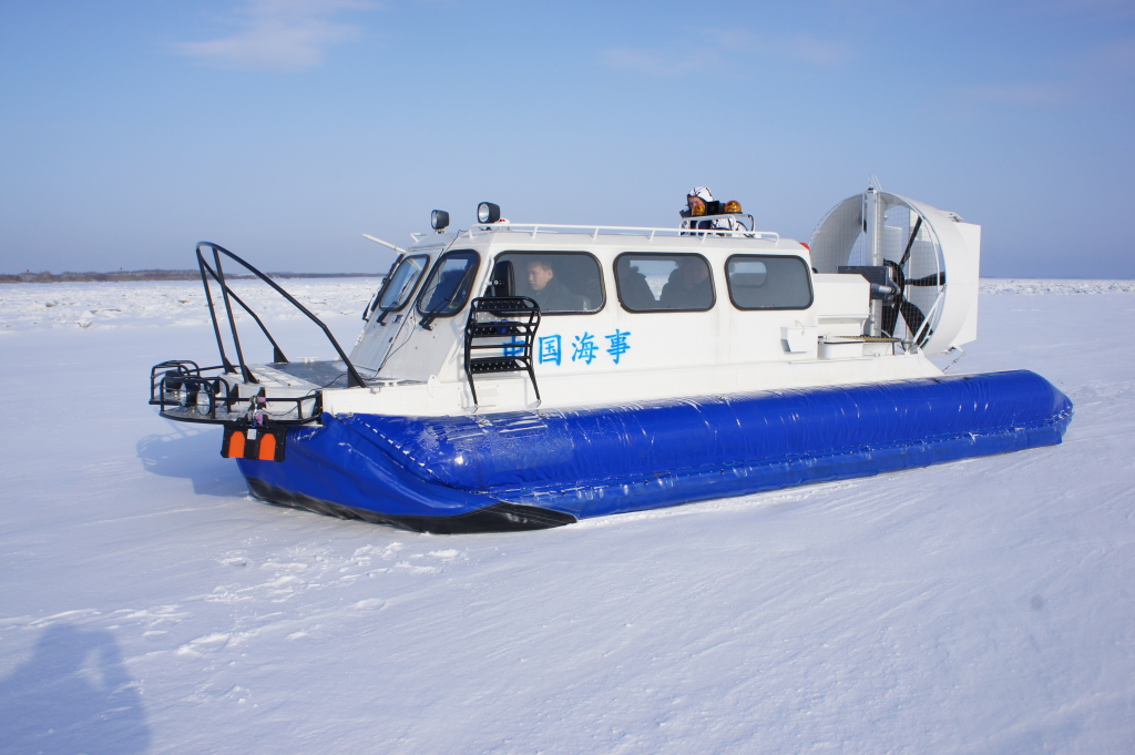
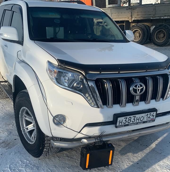
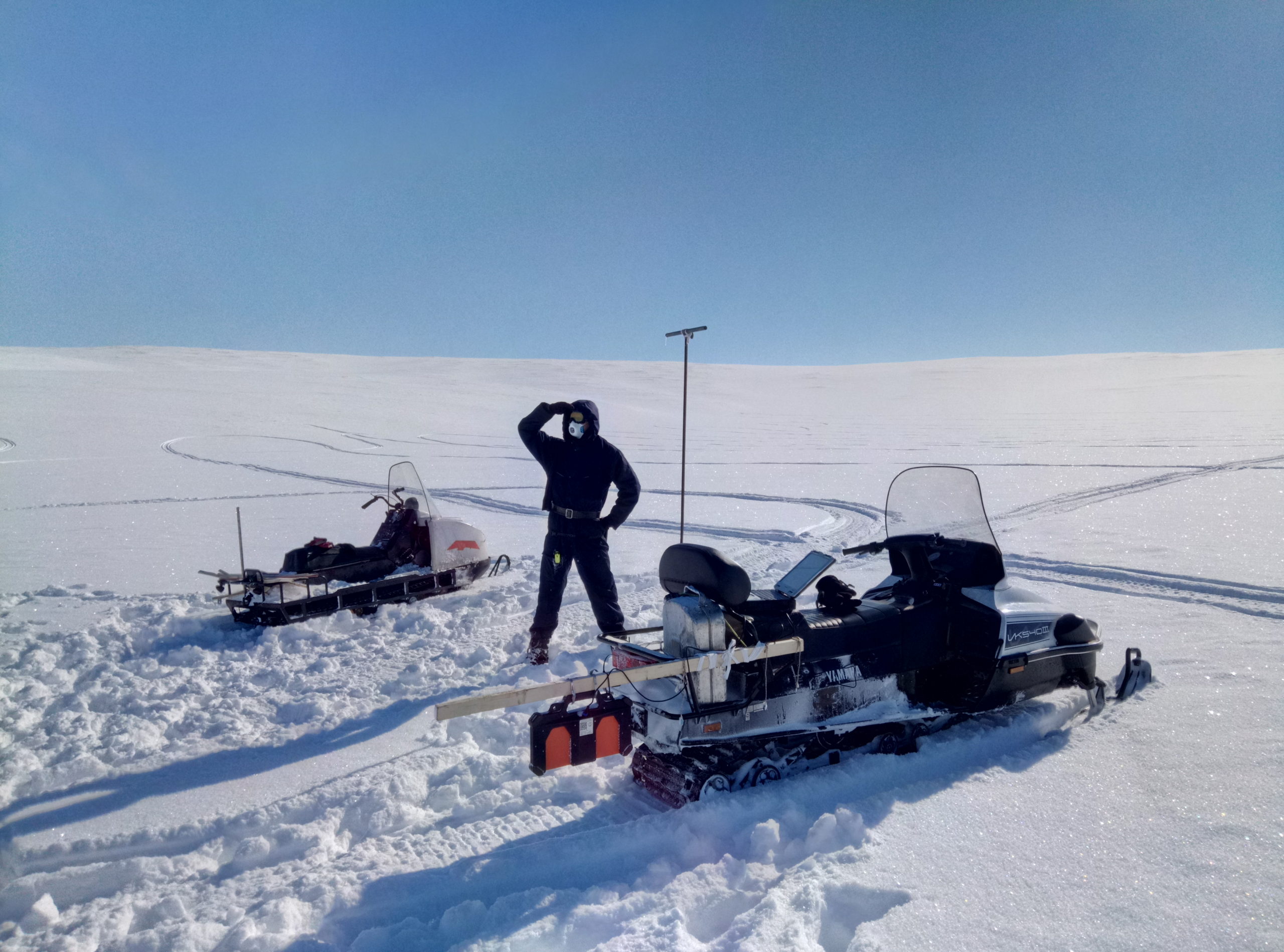
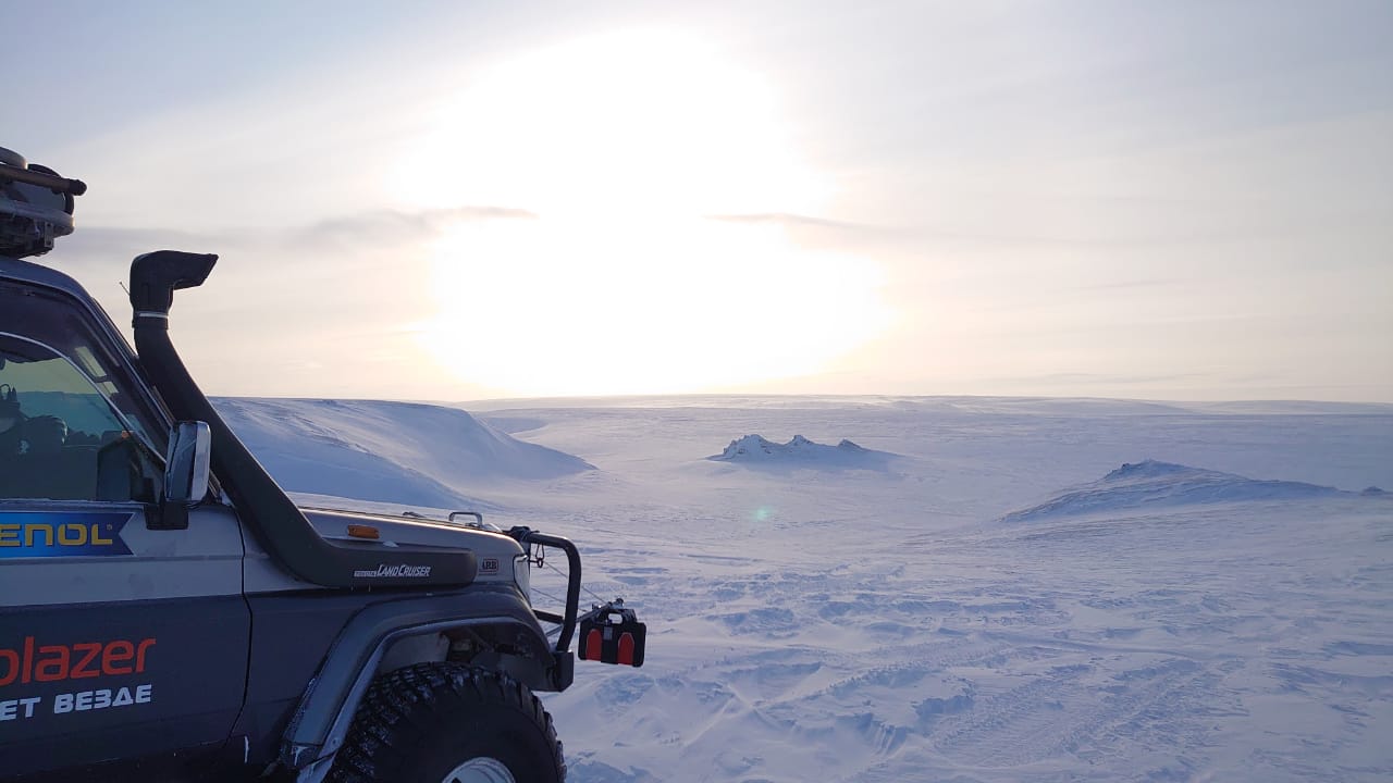
- possibility of measurement with the vehicle. You can fasten off the device to the car (all-terrain vehicle, a snowmobile, a hovercraft) and simply drive through the surface of the ice. Measurements are made automatically at speeds up to 40 km/h
- possibility of recording the measurement results for later study in comfort office, not in the cold outdoors. If you are using GPS/GLONASS receiver track are recording simultaneously with the signal of the ice thickness, and in the program you can see at every point of the track on maps downloaded from the Internet the thickness of the ice at this point
- opportunity to “see” the entire thickness of the iceand determine crack inside it which cannot be achieved by drilling.
Areas of use:
- control of safety during movement of vehicles on the ice crossing for state organizations and organizations operating ice crossings
- continuous monitoring of the ice thickness on frozen rivers and reservoirs for state organizations, fishermen, etc.
- safe transportation of heavy machinery on sea shelf, winter roads and ice crossings for oil and gas, transport companies operating in the Arctic regions
- meteorological monitoring: getting data for prevention the seasonal floods.
Equipment
For convenience of selection a suitable configuration of PicoR-Ice device it is formed some typical complete sets, each for solving a specific range of tasks. When ordering you can choose any of the options from the list of device configuration.
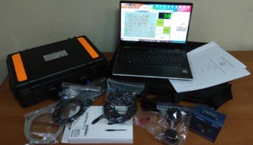
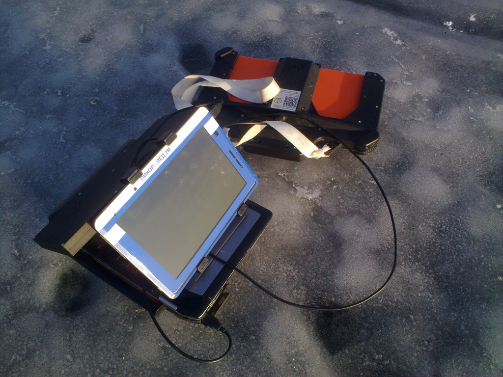
Basic set – the minimum kit of device necessary to measure the thickness of ice or perform other GPR tasks. The basic set includes:
- antenna module PicoR-2;
- USB-cable with sealed connector, 2 m;
- USB-cable with sealed connector, 4.5 m;
- PicoR software.
In this case the customer uses his own tablet PC or laptop for processing and visualization of the signal.
Complete set – the kit of device that includes everything you need for working in handheld mode (with a tablet PC or laptop transformer in a bag on your chest) and the PicoR-2 module in your hand, and for working in transport mode (with the device attached to the vehicle and using a GPS receiver). The complete set includes:
- antenna module PicoR-2;
- USB-cable with sealed connector, 2 m;
- USB-cable with sealed connector, 4.5 m;
- PicoR software;
- laptop transformer or tablet PC/ laptop in a protected version, depending on the customer’s requirements;
- car charger for tablet PC or laptop transformer;
- transport bag;
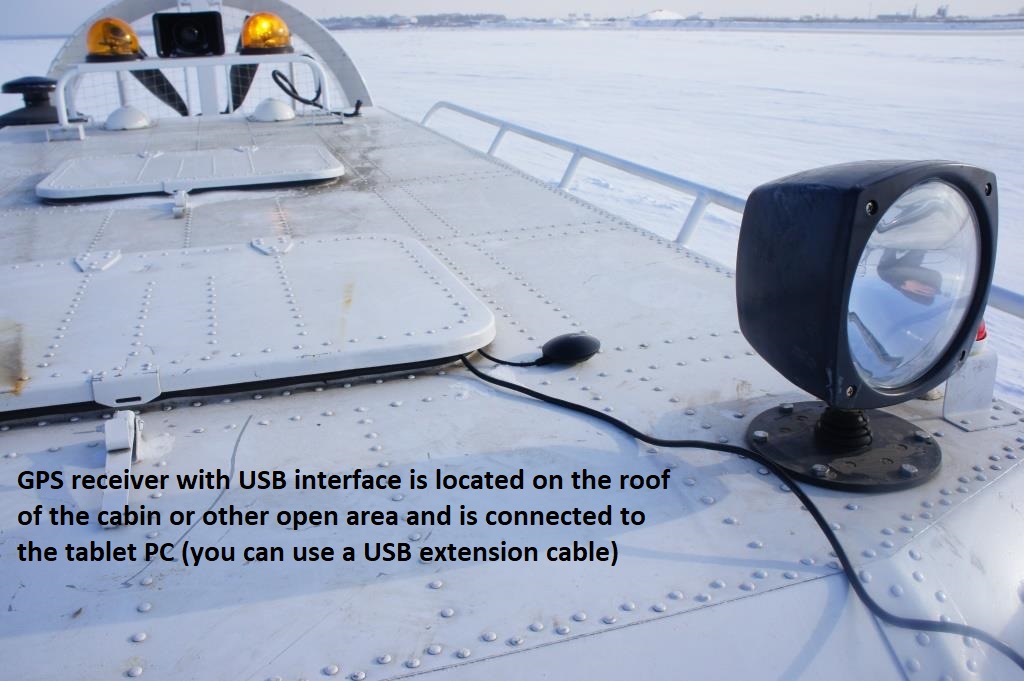
- GPS receiver with USB interface;
- USB extension cable, 3 m;
- mounting of the PicoR-2 module on the vehicle.
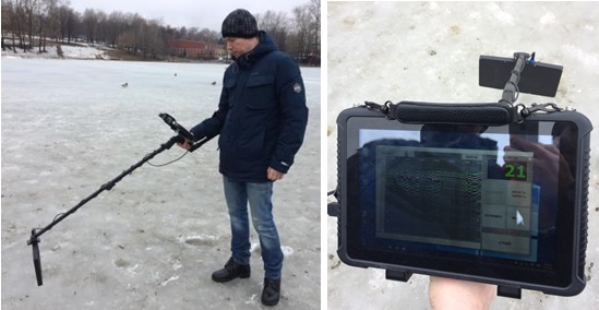
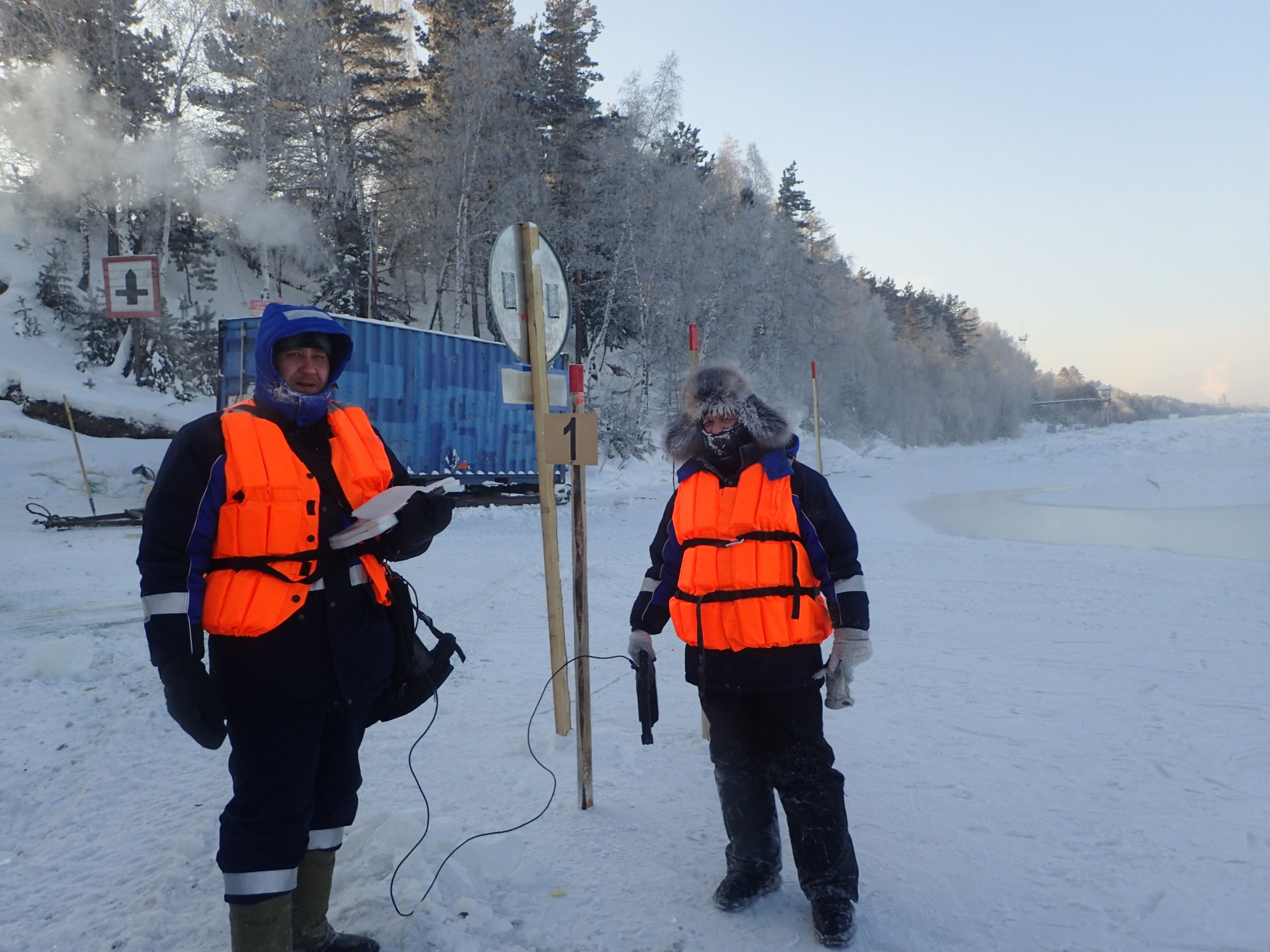
Walking set – the kit of device for convenient and safe work on foot, including an antenna module placed forward in front of the operator at a distance of up to 1.5 m on a convenient telescopic rod with an elbow support for safe measurement of ice thickness and reducing the risk of falling through thin ice, and a protected tablet in a frost-resistant design for long – term work on the street. The walking kit includes:
- antenna module PicoR-2;
- USB-cable with sealed connector, 2 m;
- PicoR software;
- tablet PC in the protected version;
- telescopic rod with tablet PC holder;
- transport protective case.
In addition, services may be provided for the preparation of measurement reports by a geophysicist based on the records made by the device.
A lower-frequency PicoR-3 antenna module can be used to probe the road surface, ground, thick ice, and snow. It differs from the PicoR-2 module only in frequency, size, weight and uses a more complex mounting system. It is convenient to order the PicoR-3 module as an antenna part and housing and then, if necessary, rearrange the transceiver module PCB between the PicoR-2 and PicoR-3 modules to increase the functionality of the device kit.
Parameters
| № | Name | Value |
|---|---|---|
| 1 | Measured thickness for ice (snow) | 5…200 cm (5…300 cm) |
| 2 | Central frequency of antenna module PicoR-2 (PicoR-3) | 1600 MHz (1200 MHz) |
| 3 | Measurement accuracy | 1-2 cm |
| 4 | Resolution (minimum size of the object) | 3 cm |
| 5 | Battery life (powered by tablet PC or laptop and almost equal to their battery life) | up to 4-5 hours |
| 6 | Number of measurements per second (depending on settings) | 50 |
| 7 | Vehicle speed during the measurements | up to 40 km/h |
| 8 | Height of antenna module above the surface | 20-100 cm |
| 9 | Field of view (diameter of the survey area at height of separation of the antenna module from the surface 50 cm) | 50 cm |
| 10 | GPS positioning support | yes |
| 11 | Size of antenna module PicoR-2 (PicoR-3) | 39 х 30 х 13 cm (56 х 45 х 16 cm) |
| 12 | Weight of antenna module PicoR-2 (PicoR-3) | 2 kg (5 kg) |
| 13 | Operating temperature range of antenna module | -40 … +50 °С |
| 14 | Readiness time | less than 1 min |
| 15 | External interface of antenna module | mini-USB, sealed |
| 16 | Protection class of antenna module | IP67 |
| 17 | Computer operating system | Windows 7, 8, 10, Android (via remote desktop) |
| 18 | Data format compatibility with other programs | RadExplorer, GeoScan via MatLab converter |
Principle of operation
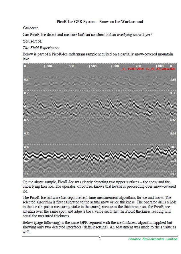
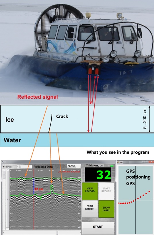
The principle of the PicoR-Ice operation is schematically shown in a figure. A pulsed ultra-wideband radio signal of low power is emitted by the transmitting antenna deep into the environment, reflected from the interfaces of environment with different permittivity, and received by the receiving antenna. After the initial processing and digitization, the useful signal is transmitted via a USB cable to the computer for further processing and visualization. The device is also powered via a USB cable, i.e. there are no batteries inside the antenna module placed outside, usually at sub-zero temperatures.
When working in manual foot mode, the operator must hold the antenna module by the handle at a height of about 0.5 m. A perpendicular or longitudinal position of the antenna module with respect to the axis of movement is allowed. When operating in transport mode, fasten the antenna module to the vehicle. For optimal measurement of ice thickness at the point, it is necessary to smoothly shake the antenna module up and down with an amplitude of about 1-3 cm and frequency of 1 time in 1-2 seconds. THE DEVICE IS NOT INTENDED TO WORK IN A STATIC POSITION. Measurements take place only when it moves relative to the ice surface (either up and down in place, or along).
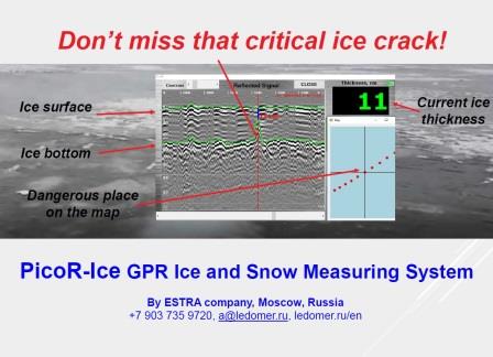
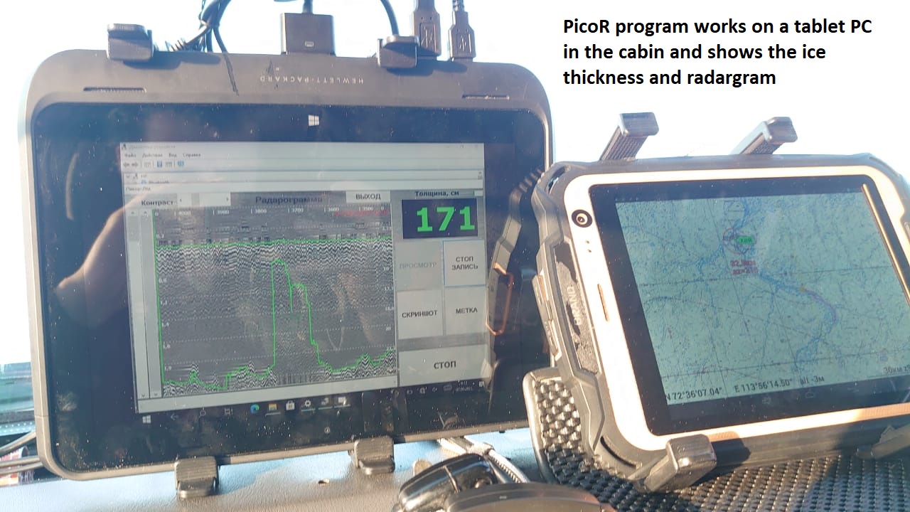
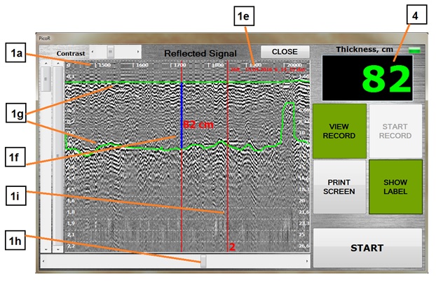
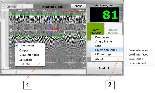
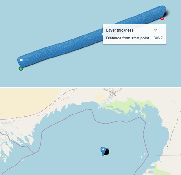
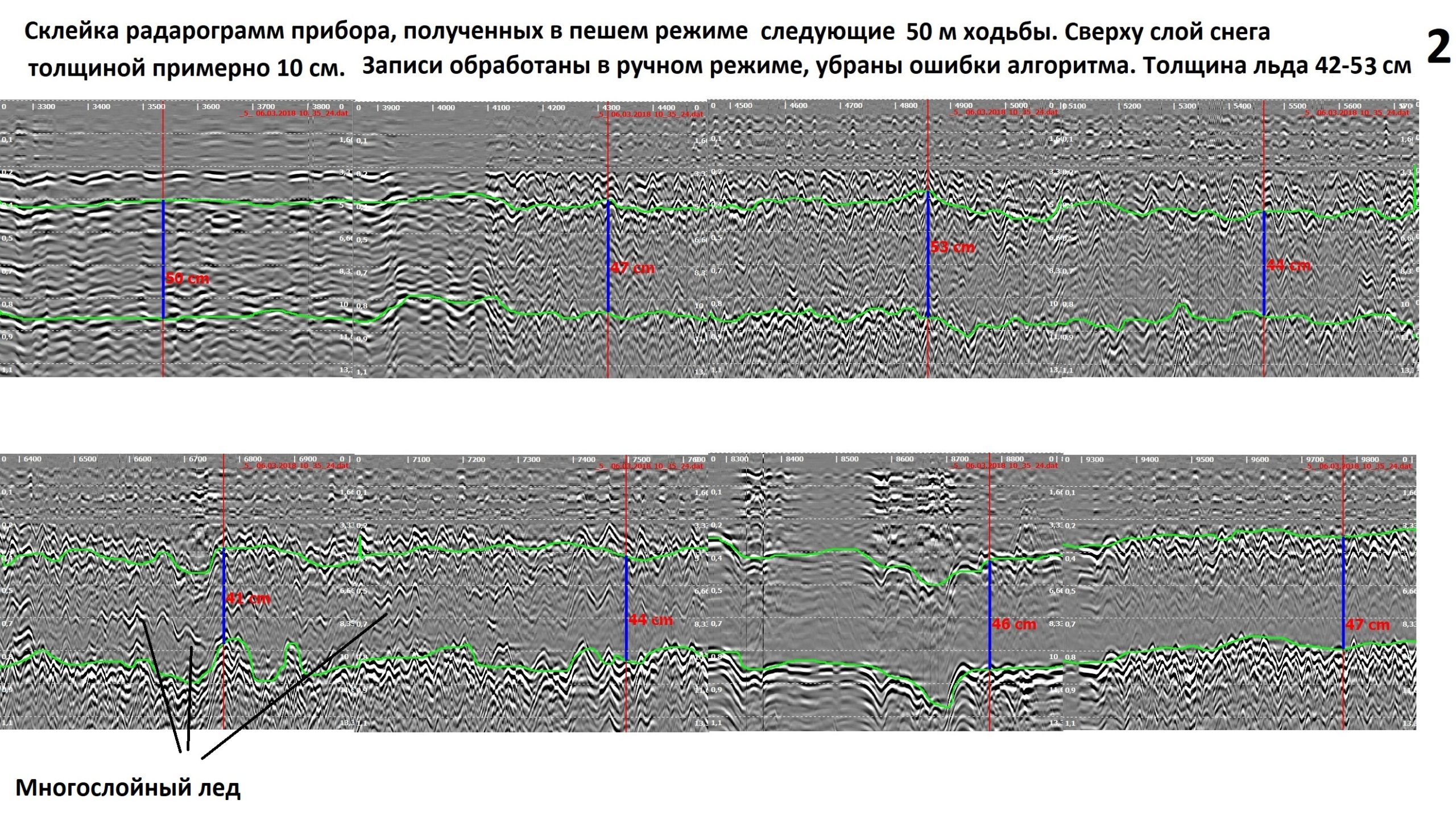
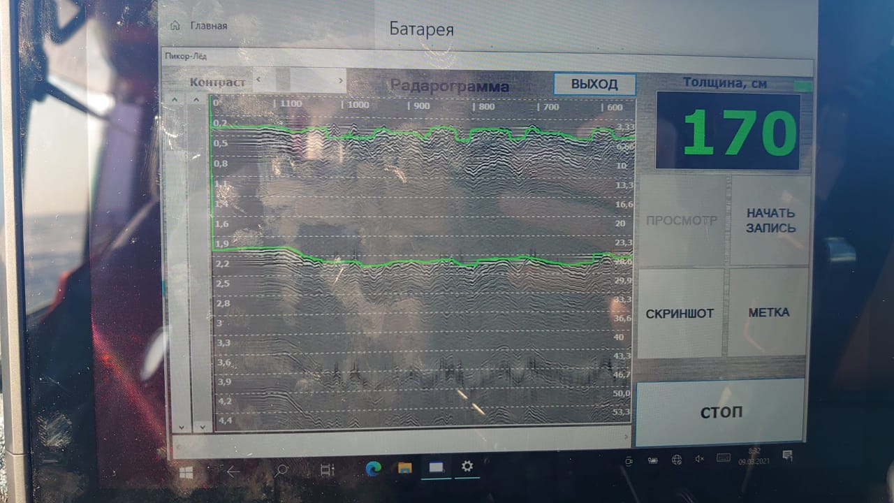
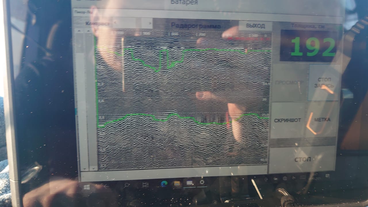
Information about the reflected signal is visualized on the radar image (radargram). On the vertical axis, the thickness (the time of propagation of the radio wave) is counted, on the horizontal axis – the time (the number of measurements). Using signal processing software allows to automatically calculate on radargram the difference between boundaries of air-ice-water and determine the thickness of the monolithic ice. The window shows the current ice thickness in cm. In a separate window, a map is opened, where the GPS track of the device positioning is displayed, on which each point of the track corresponds to the value of the ice thickness.
Radio emission of the device fully complies with the regulatory authorities limits and dozens of times less than that of a cell phone. Therefore PicoR-Ice is completely safe for the user.
Software
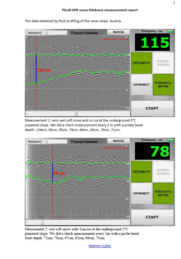
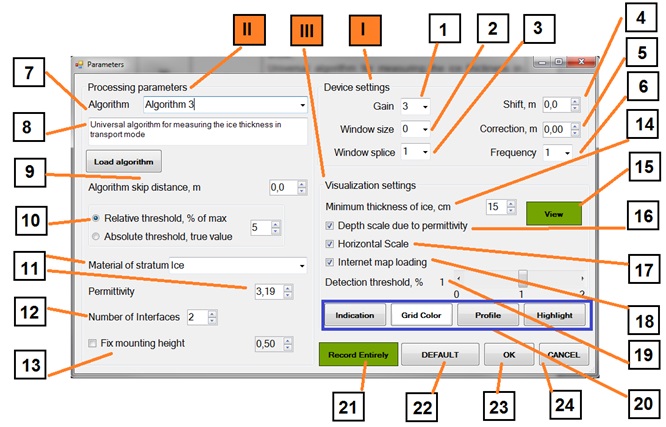
PicoR-Ice software (latest version 5.0) is designed to control the parameters of the antenna module, visualize the reflected signal on the radargram (vertically – the thickness in the environment, horizontally – time) in real time, record the reflected signal, use various algorithms to automatically calculate the distance between the boundaries of the air-ice-water environments and determine the thickness of monolithic ice, record the track from GPS receiver and display it on the map with reference to the measurement data of the device. It works under the Windows operating system.
The figures below show the graphical interface and some of the functionality of the program. The radargram window displays visualized information about the signal change over time in a density form. Usually a layered structure with the clearest boundaries is visible, when measuring the distance between which the thickness of the corresponding layer is determined. The highlighted environment boundaries are shown in bright green. The scale on the left shows the distance in meters, the scale on the right – in nanoseconds. The horizontal scale indicates the frame (measurement) number.
The program provides for the device to operate in the recorder mode, i.e. to record files of an acceptable size without having to stop recording to save and start again, similar to the DVR function on a car. There are two context menus and an additional options menu for setting various parameters and calling tools. For a more detailed acquaintance with the program features, you can request the operating manual for the device.
Report
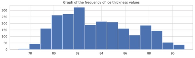
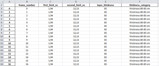
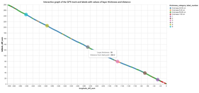
The analysis of measurement data and the preparation of the report must be performed on the record with fully correct layer boundaries. If there are incorrect border jumps in the record, they need to be corrected manually and save the correct boundaries using the appropriate tools. After processing the data according to the instructions, we will receive an Excel file with ice thickness data for each measurement, category by thickness, distance from the beginning of the measurement segment. Examples of graphs that can be obtained for the report are shown below.
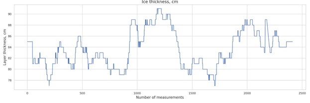
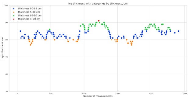
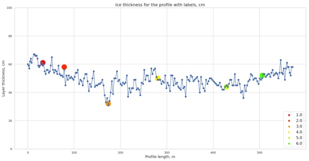
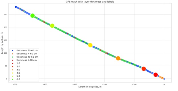
You can also get an interactive graph with a GPS track with a layer thickness, where you can find out the thickness and distance from the beginning of the track for each point by hovering the mouse cursor, zoom in on any area, and an interactive graph with a GPS track with a layer thickness immediately on the OpenStreetMaps map.
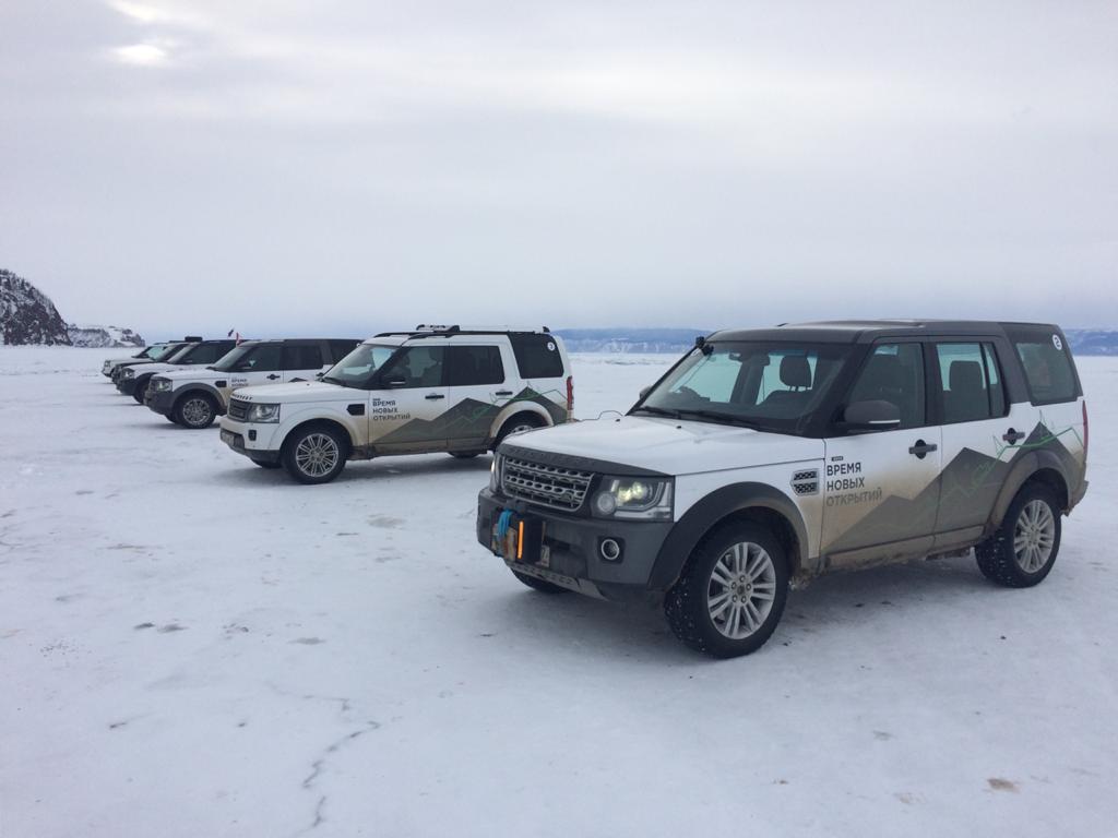
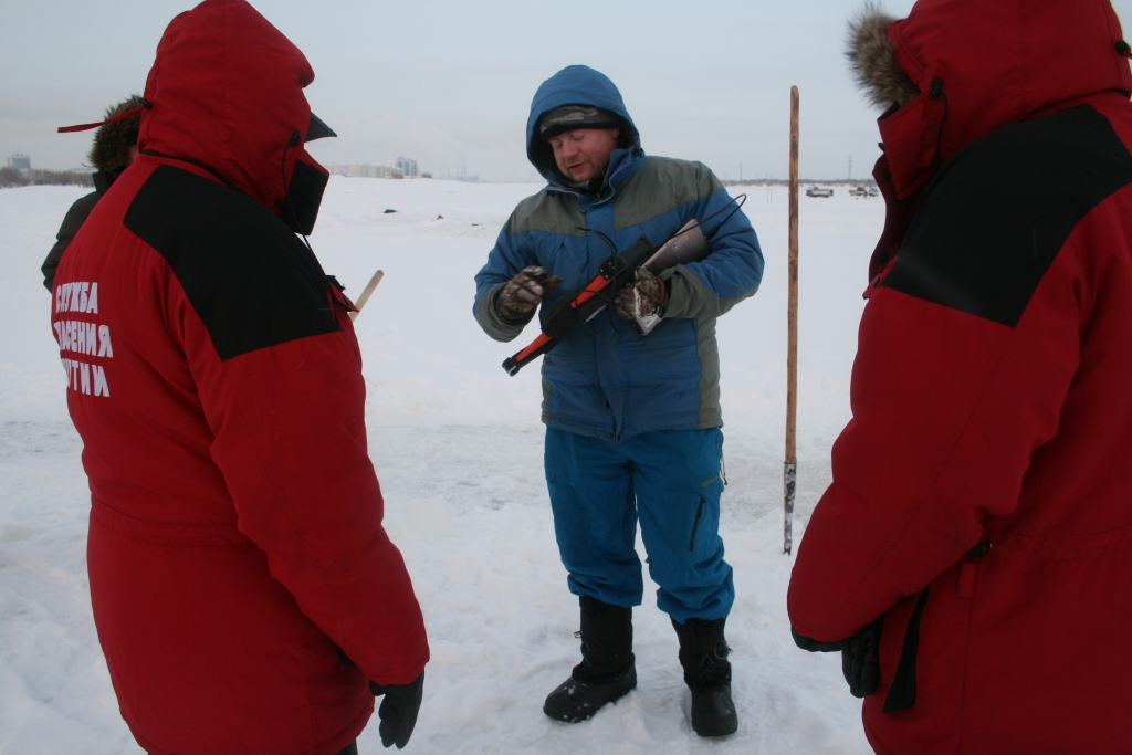
Work examples
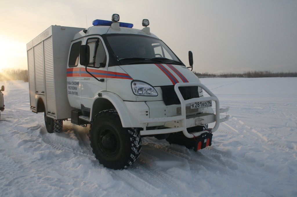
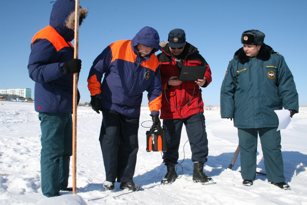
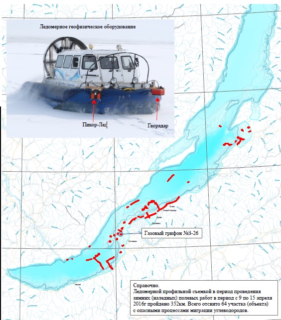
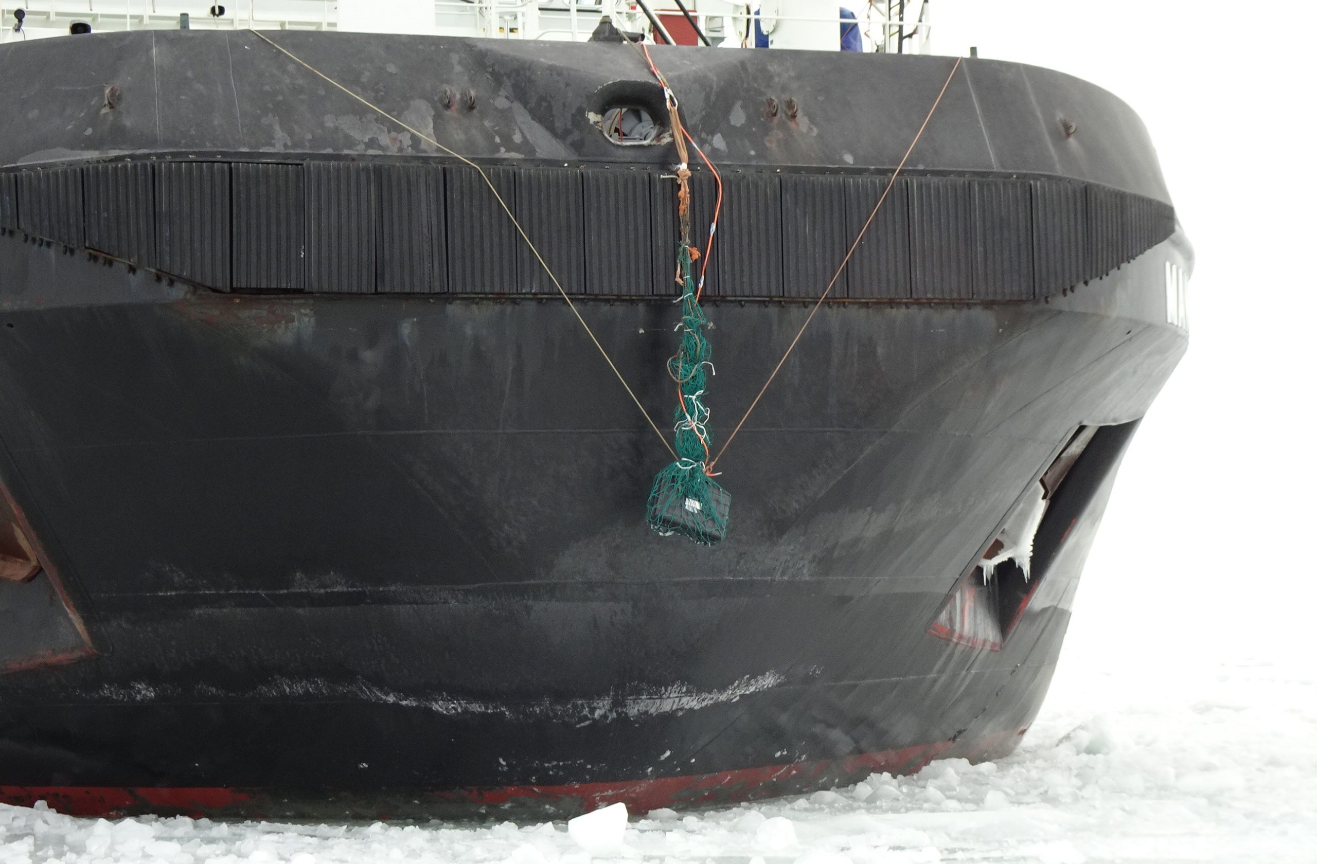
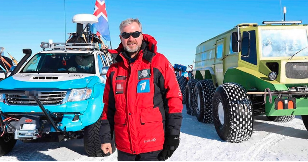
Since 2012, more than 200 PicoR-Ice GPR devices have been manufactured and delivered to users. Among our customers are the Ministry of Emergency Situations, Federal Hydrometereology Service, Rosavtodor, AANI, Surgutneftegaz, Rosneft, Gazprom, Norilsk Nickel, Alrosa and many other companies and individuals. Most of the devices are used in the regions of Siberia, the Arctic and the Far East, where there are a large number of winter trucks and ice crossings through which transportation is carried out. Many devices are used in oil and gas producing regions to ensure the safety of transporting heavy equipment on ice in winter (for example, through the Gulf of Ob). The devices are successfully operated in scientific organizations, travel companies. The images below show some examples of the use of Picor-Ice devices.
Also, our devices have been exported and are successfully working on the ice roads of Canada, lakes of Finland, in the northern provinces of China.


Feedback
Below you can find reviews of our customers about the PicoR-Ice device, reports on the operation of the device, methods of working with the ice meter, presentation materials, certificates of the PicoR-Ice device, regulatory documentation.